Bing Maps: DriveTime Calculations
Looking at catchment areas and identifying drivetimes such as, for example, distance from retail centre, airport, or perhaps some kind of event, can be a really useful marketing tool. The FastStats Map tool provides various ways in which to select people geographically, including a number of options for calculating drivetimes.
In this example, let's consider drivetimes from the Apteco offices in Warwick.
-
Open a new Map from the FastStats toolbar
-
Right click on the map and select Search
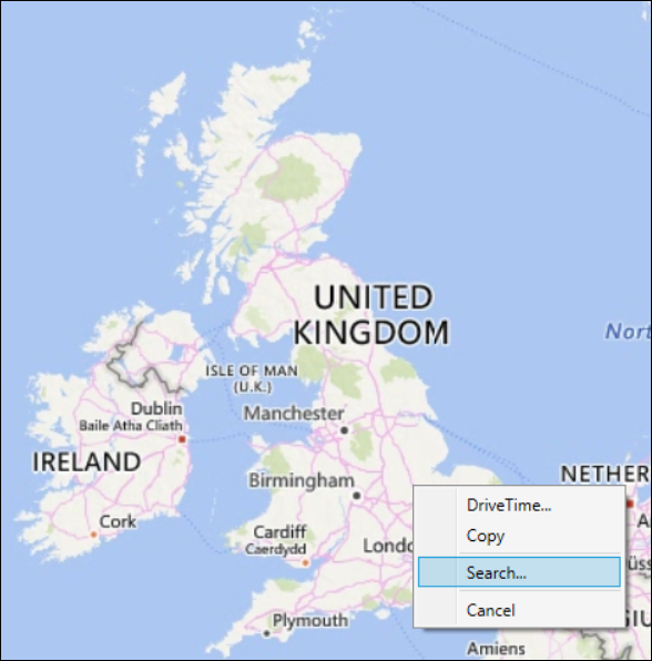
You can search for your location by name, postcode, postal sector etc., or by latitude and longitude co-ordinates.
-
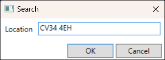
In the Location panel, enter the postcode - CV34 4EH and OK
The map will zoom in to the defined centre point:
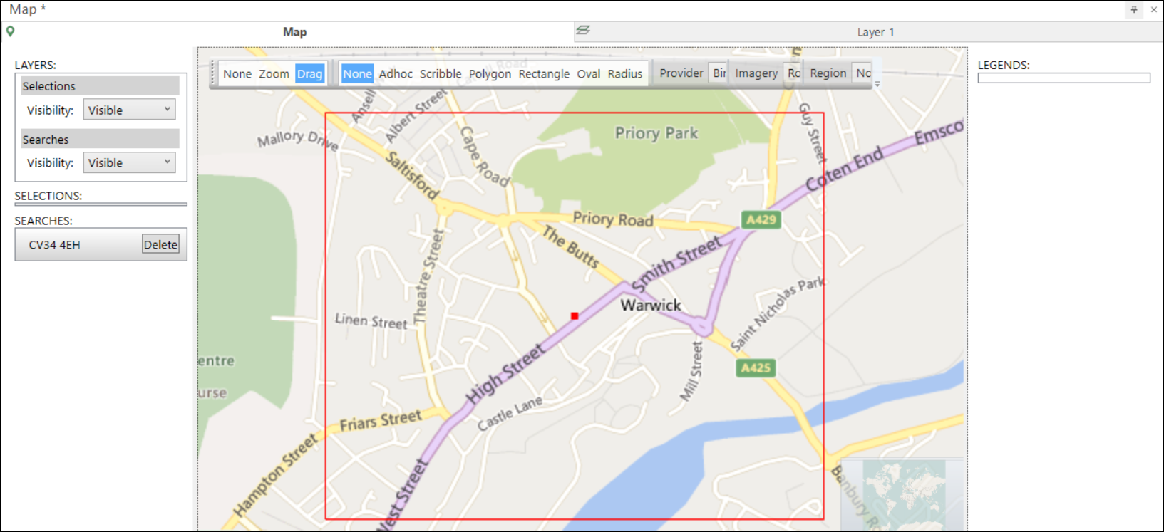
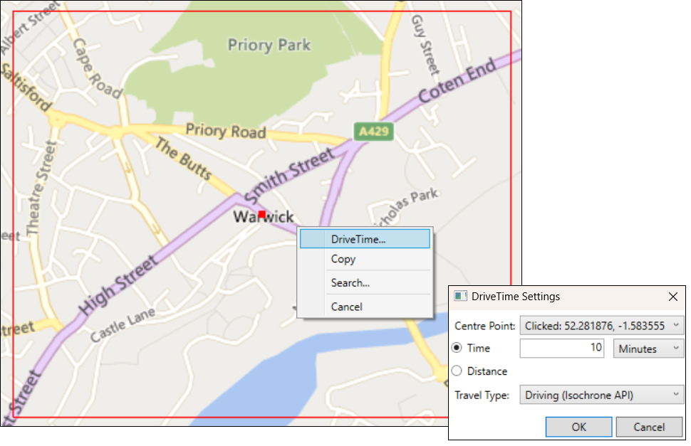
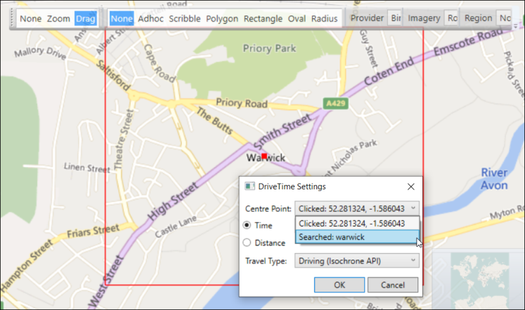
You can access the drivetime options by right clicking anywhere inside the red boundary that identifies your centre point and selecting Drivetime...
Added in Q4 2023
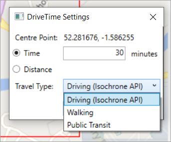
When creating drivetime analysis, you have two choices for selecting the origin of the drivetime - either the point you clicked, or the point you searched for.
-
Simply click the Centre Point drop-down and select
This helps to produce more accurate drivetimes in circumstances such as when supplying the Bing Isochrone API with a centrepoint that is not near any roads.
Driving (Routes API)
From Q1 2023, Driving (Routes API) is no longer supported and Bing Isochrone API is used to calculate Map drivetimes - see below.
This method of calculating drivetimes uses an algorithm to calculate a set of endpoints in terms of miles or minutes, creating a shape with a fixed number (65) of vertices from the centre point.
The example below shows the result of creating a drivetime of 30 minutes from the Apteco offices:
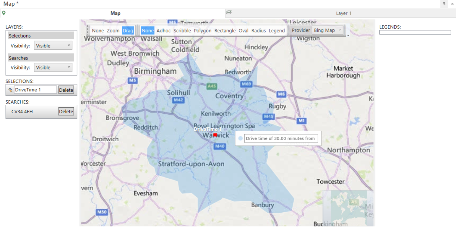
The shape indicates that where there are main roads, it is possible to travel further within the defined time - for example along the M42, M69 and M40 motorways. Where the route includes less major or country roads - for example towards Stratford-upon-Avon or Rugby - you cannot travel as far.
Using Driving (Routes API) takes approximately 30 seconds per drivetime to create and requires multiple API calls.
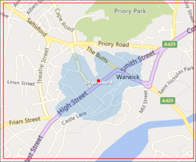
You can drag the selection from the map to count the number of people captured within the drivetime zone:
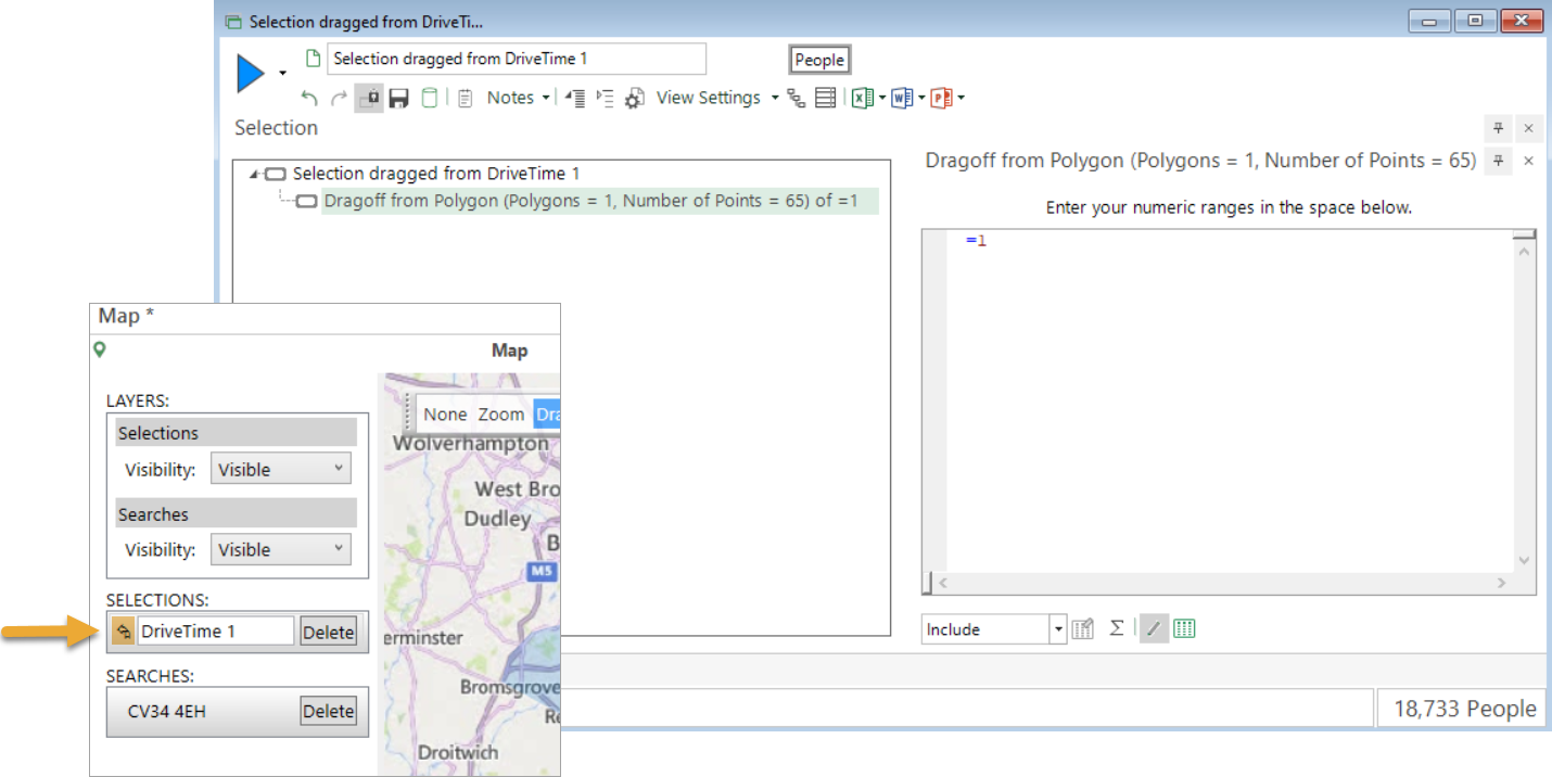
In this example the selection count is 18,733 people. With latitude and longitude defined on this system, expanding the selection tree shows that the drag off comprises of a polygon with 65 points. You can go on to examine the FastStats expression used by clicking on the  icon at the bottom-right of the selection window:
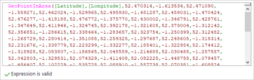
The GeoPointInArea expression tells you, for each person, whether they fall within the shape drawn; there are 65 points listed.
Driving (Isochrone API)
You can also use Bing Isochrone API to create a drivetime zone:
-
Create a new Map and search for CV34 4EH
-
In the DriveTime Settings dialog, change the Travel Type to Driving (Isochrone API)
Because this method does not have a fixed number of endpoints (typically the resulting shape has between 500-800 vertices, depending on the complexity of the road network and the drivetime time or distance set), the drivetime results are much more accurate:
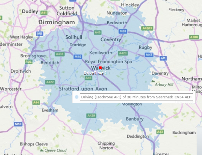
You can see that the complexity of the shape is far greater than when using the default Driving (Routes API) method. For example, areas such as along the M5 towards Droitwich in Worcestershire, or past Stratford-upon-Avon towards Evesham, are now captured when, previously, they were not. The drivetime shape is more accurate.
Using Driving (Isochrone API) is much faster for small drivetimes, taking approximately 5 seconds for the example 30 minute drivetime shown above.
When you drag from this map to create a selection, it returns a higher count - 20,387 people in this example - and you can see that the polygon comprises of 722 points:

The Bing Isochrone API also supports two further modes of travel:
Walking
In some cases, you may wish to look at the number of people within walking minutes or distance of a centre point - for example, a coffee shop or restaurant looking to do a local promotion:
Public Transport
You can calculate drivetimes based on travel time or distance by public transport from your centre point - for example to see how far you can get from the Apteco offices in 30 minutes by bus or train:
![]()
The public transport option assumes that you are leaving the centre point at the current time; the shapes generated are dependent upon, and vary according to, the time of day that you carry out your drivetime analysis.
Some considerations when creating drivetime analysis
-
How accurate do you need the drivetimes to be? How fast do you want the drag-off selections to run?
In the above examples of 30-minute drivetimes centred around the Apteco offices in Warwick, you can see polygons of 65 v 722 end points The latter ensures greater accuracy and is reflected in the number of people calculated to be in each shape. However, you should bear in mind that when dragging off and creating selections from your drivetimes, the speed at which the selections run is dependent upon the number of points being calculated within the GeoPointInArea expressions. Here, for example, using the more accurate Isochrone API creates a selection that will potentially run more than 11 times slower than the Routes API.
Related topic: