Bing Maps: Penetration Mapping - comparing records against an outside population
As well as being able to compare two groups of people within FastStats - i.e. Sweden customers vs. all customers - it is also possible to take records within your FastStats system and compare them against an outside population. For example, you might wish to compare your whole customer base against an overall population count for each postal area. You can achieve this by using a lookup file that has one row for each postal area and the relevant geo-demographic information.
-
Create a new shaded map with Postal Area as the geographic variable to use.
-
Click Selections and drag on a selection of All People as the analysis group.
-
Switch to the Base Selection tab and select From File.
-
Right click within the Drop your input file here drop-box and select Browse.
-
Navigate to the saved input file and select.
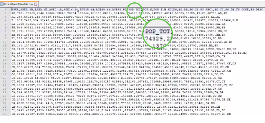
In this example, a data file supplied with our shape files is used. In the first column it has all the UK postal areas, as well as various age groupings, total population and other geo-demographic information.
-
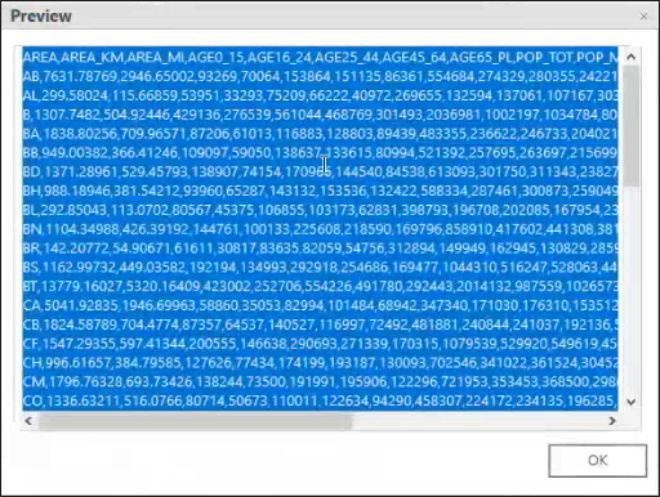
Once selected, click Preview to see a sample of the data.
-
Apply the required settings and select the measure you want to display.
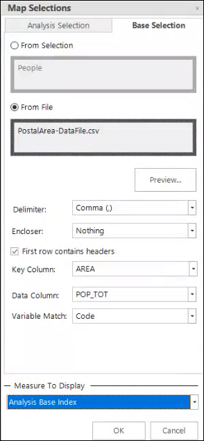
Here, by selecting POP_TOT as the data column, you can compare the count of people in each postal area within your FastStats system against the total population per postal area provided in the data file.
-
Click OK.
As FastStats takes the total as the Sum(All Rows), if the total is not that then it cannot return sensible results. The following message displays to inform you of this.

-
Click OK and rebuild the display.
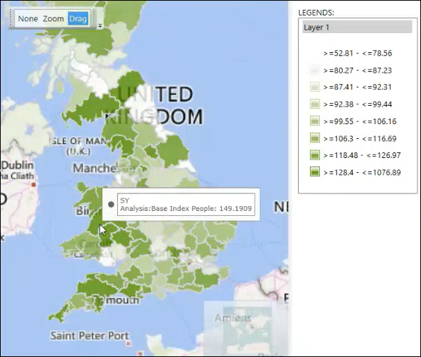
The map now provides completely new insight and it is clear, for example, that customers in Wales and the south west of England are over-represented when comparing all of the Holidays system customers to the underlying populations in each postal area.
The key column in the external data file must exactly match the codes of the corresponding geographic variable in your FastStats system - here, the postal area code.
Whilst the above example is a typical use case and uses a base population from a file - here, population total - to compare against, you can look up any value column so, in other circumstances, it could be an area, some other demographic, a ratio value, or anything that is relevant to the data being mapped.
To provide further flexibility, you can choose to have the analysis from a file and the base from a selection. For example, you might have some sort of multiplier as a ratio from 0 to 1 and want to take your customers and multiply them by this ratio. In this instance, you would use the analysis from file, a base as customers from a selection of all people, and select the Analysis*Base measure.
Though very unusual, you could choose BOTH analysis and base from a file. One such example would be to look into the postal area data file and have the analysis as the population and the base as the area to give a thematic map of the population density in each postal area.
Related topic:
Bing Maps: Penetration Mapping
Bing Maps: Penetration Mapping with Z-Scores