Bing Maps: Plot Map - Using Longitude and Latitude Co-ordinates
For the greatest precision, and to keep Bing transactions to a minimum, it is recommended that you use longitude and latitude co-ordinates as variables to create plot maps, rather than geographic variables such as UK Postcode or US Zip code.
For example:
-
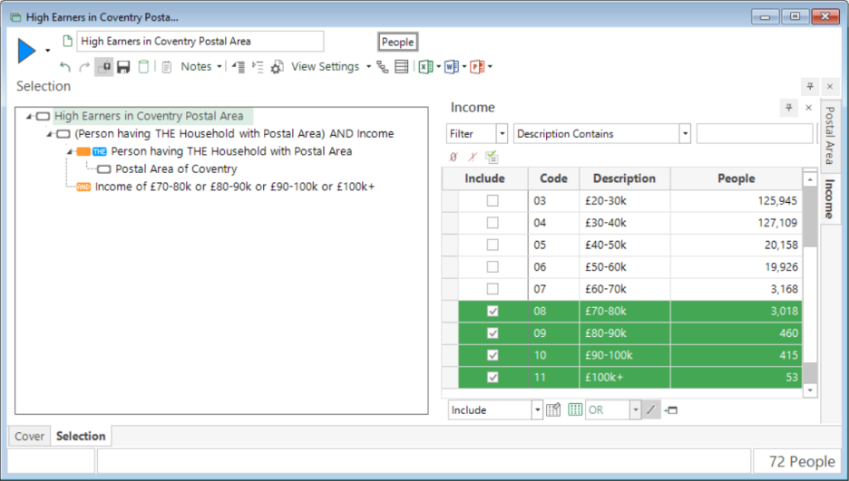
Create a selection identifying people in the Coventry Postal Area earning £70-80k and above - High Earners in the CV Postal Area.
-
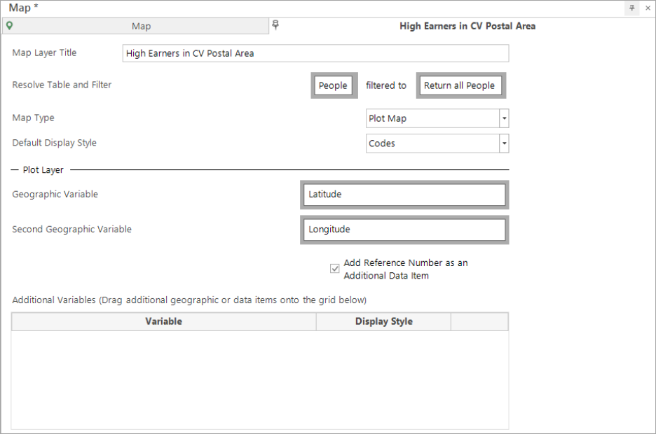
Drag and drop the Map tool on top of the selection window.
-
Click on the Layer 1 tab.
-
Change the Title to High Earners in CV Postal Area.
-
Drag and drop your Latitude variable as the first geographic variable, and Longitude as the second.
-
Build the display.
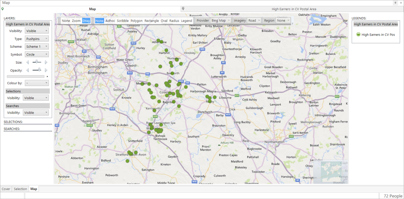
When you zoom in over the CV Postal Area of the resulting map, you will see a pinpoint to represent the location of the people represented in the underlying selection - in this example, High Earners in the CV Postal Area.
Related topics: