Territories Wizard: Overview
PLEASE NOTE:
This wizard is not available for Bing Maps.
The Territories wizard can be used to manipulate MapPoint Territories from within FastStats using the Map tool. Territories are useful for partitioning geographic areas to be used - for example - as sales regions, etc.
The Territories Wizard allows you to display a summary variable (created using the Combine Categories Wizard) that summarises a geographic variable (such as Postcode District) within MapPoint. The wizard also lets you take territories defined in MapPoint and create a new Virtual Variable from them to be used in further FastStats analysis.
Example:
In this example, we will create a selector type Virtual Variable to find the number of Households in the country regions of England, Scotland and Wales, as defined on a MapPoint map.
First you will need to define the territories on the map:
-
Drag the MapPoint tool onto the workspace and click on the
 Territories button
 -
From the Method window select the Create manually radio button. Click Next
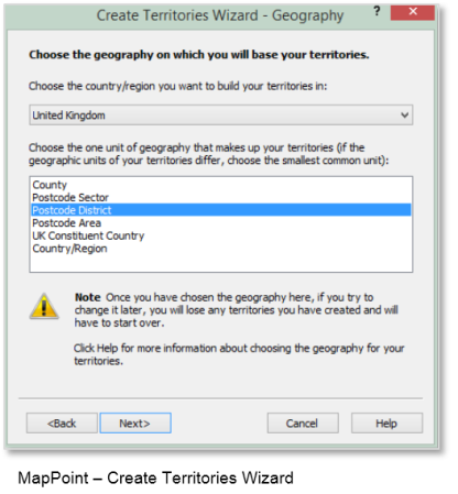
-
From the Geography window highlight Postcode District. Click Next
-
The final window gives you some tips on selecting your territories on the map. Click Finish
-
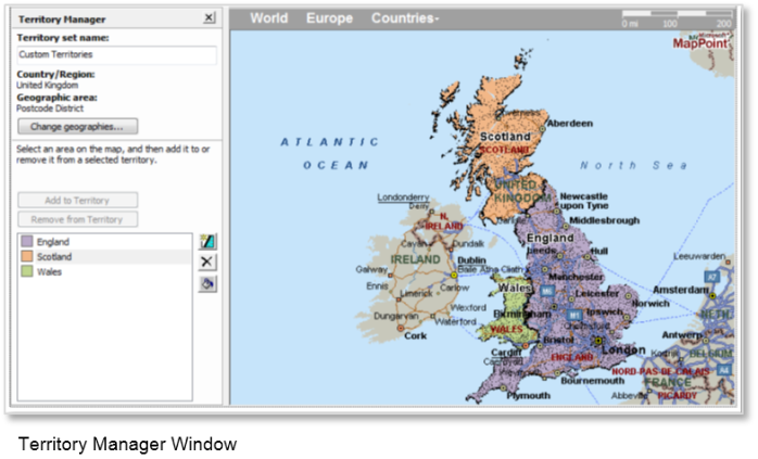
Name your first New territory as England and start to make your selections. Continue until you have 3 territories - England, Scotland and Wales
-
Save the MapPoint as UK Country Regions
The next stage is to use the Territories Wizard to create a Virtual Variable from the definitions you just made in MapPoint.
As you already have the MapPoint window open that you want to use, you can click on the  Territories Wizard icon at the top of the window to start the wizard - Territories