Installing boundary map files
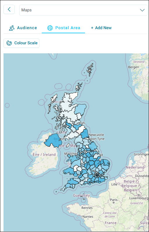
Postal maps display geographical boundaries with thematic shading that represents data values across different postal areas, districts, and sectors. These visualisations help you identify patterns and trends in your data by location.
You can simplify geographical shape file management by using JSON files instead of traditional .shp and .dbf files in FastStats and Orbit. This approach simplifies file management while maintaining full functionality.
Pre-requisite
Before adding new shaded postal map files, remove the .shp, .dbf, .shx, and .lic files for Postal Area, Postal District, and Postal Sector from the client binaries.
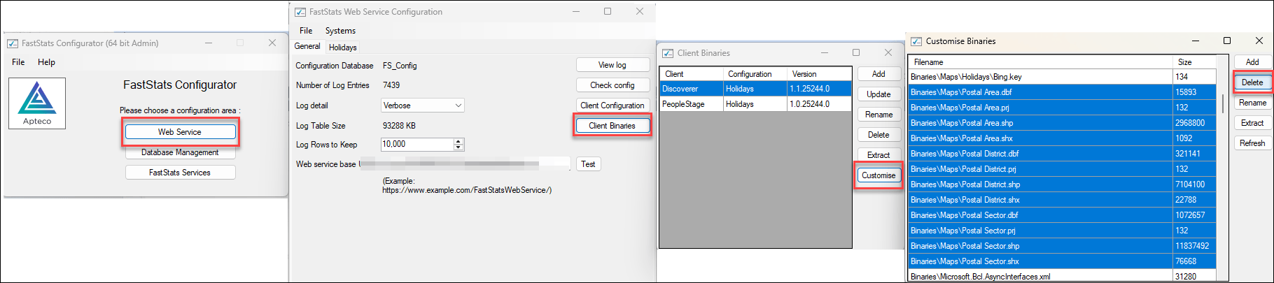
To do this:
- Open your FastStats Configurator.
- Select Web Service.
- Select Client Binaries.
- Select each Discoverer client in turn and select Customise.
- Select any existing Postal Area, Postal District, or Postal Sector files.
- Select Delete.
You can now begin installing your JSON files.
Downloading map files
Before installing JSON map files, download the standard map files from the Apteco portal.
To download map files:
- Go to portal.apteco.com/software-releases and log in.
-
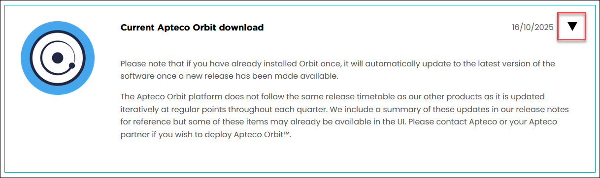
Expand the Current Apteco Orbit download section.
-
Download the appropriate map file:
- OrbitBoundaryMaps.zip: contains UK postal areas, German and Swiss 2 digit postcodes, Dutch provinces and municipalities, US states, and a world map, as
.geojsonfiles - UK Shaded Postal Maps yyyy-mm.zip: contains UK postal areas, districts, and sectors, as
.jsonfiles (only available if you have purchased the detailed UK postcodes add-on)
- OrbitBoundaryMaps.zip: contains UK postal areas, German and Swiss 2 digit postcodes, Dutch provinces and municipalities, US states, and a world map, as
Installing map files in FastStats
When you store files correctly, you see a thematically shaded shape file populated on your map.
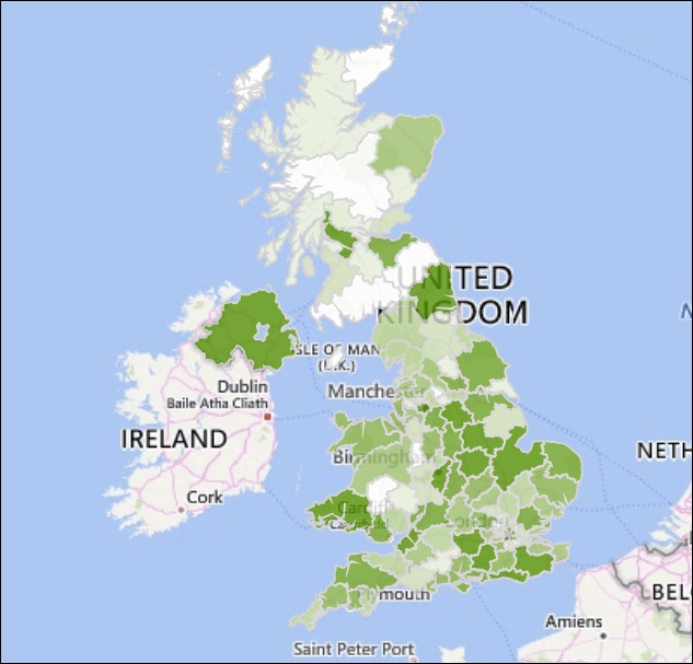
To install JSON files in FastStats:
-
Save your
.jsonfiles (for example,Postal Area.json,Postal District.json, andPostal Sector.json) on the application server in a Maps subfolder of the Project directory. Typically this is the public folder. -
To find the location of the Project folder, run the FastStats Configurator and select FastStats Services.
-
The files come as a
.zipfile. Extract to this location so that only the.jsonfiles exist there.Note
If the Maps folder doesn't exist, create one.
-
Verify your installation by checking the Debug Log when you create or use a map.
The FastStats Launcher automatically checks this folder location first when downloading shape files.
Troubleshooting
If your JSON files aren't in the correct location, the Debug Log displays an error message when you create or use a map. This indicates the system can't find the shape file.

Moving your files to the specified directory resolves this issue.
Installing map files in Orbit
After downloading the zip files from the Apteco portal, add each map you want to use in Orbit as a map definition, in Application Settings > Map Definitions. See Map definitions.
Each map definition is then available on both dashboard map tiles and audience workbook maps.
Here's how a map looks on a dashboard, and in an audience workbook.
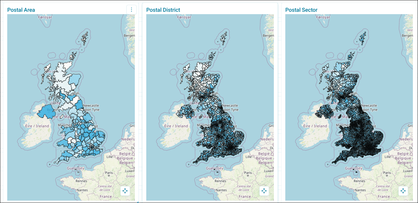
Note
If you encounter any issues, contact the Technical Services team at support@apteco.com